

The best paper maps depend on whether you need a road-trip reference, a regional map for outdoor planning, or a large display for home or office. I’d put the Rand McNally 2027 Large Scale Road Atlas first for drivers who want broad U.S. coverage in a book, while the National Geographic Adventure Map: Pacific Northwest is a standout for focused regional planning and the Swiftmaps Classic Elite Laminated U.S. Wall Map suits readers who need a large, durable display. The main tradeoffs are portability versus detail, paper versus laminated surfaces, and nationwide coverage versus local specificity. A folded map packs easily, but an atlas is easier to browse across regions; a wall map gives more visual context but takes space. Read on for the full breakdown and help matching each format to your needs.

Get furniture and decor delivered free — and shop member deals
- Fast, free delivery on millions of items
- Access to Prime Big Deal Days deals on October 6–7
- Prime Video, Amazon Music and more included
Complete the kit


Key Takeaways
- The large-scale road atlas is the strongest all-purpose driving pick in this group because its format favors legibility and trip planning, while the midsize atlases prioritize easier carrying.
- Regional maps solve a different problem from national atlases: the National Geographic Pacific Northwest map narrows the view for local exploration instead of trying to cover the whole country.
- Lamination matters most for maps handled often or displayed long-term. Swiftmaps’ laminated wall options are more suited to repeated reference than rolled paper editions, though they take more care to store flat.
- Easy-to-read formats trade compactness for legibility. Rand McNally’s midsize atlas and U.S. map are more approachable for readers who find dense, small labels hard to scan.
- Wall maps and travel maps should not be judged by the same criteria. The U.S. and world wall maps prioritize scale and display, while folded regional maps and road atlases are designed around travel use.
| Rand McNally Easy to Read United States Map |  | Best for Quick U.S. Reference | Product type: United States map | Coverage: United States | Named edition: Easy to Read | VIEW LATEST PRICE | See Our Full Breakdown |
| Swiftmaps Classic Elite Laminated United States Wall Map, 48 × 78 in | 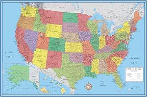 | Best for Large, Markable Wall Display | Brand: Swiftmaps | Map type: Political | Dimensions: 48 × 78 inches | VIEW LATEST PRICE | See Our Full Breakdown |
| Rand McNally Classic Edition U.S. Wall Map, Paper, Rolled |  | Best Traditional Paper Wall Map | Edition: Classic Edition | Coverage: United States | Map format: Wall map | VIEW LATEST PRICE | See Our Full Breakdown |
| National Geographic Adventure Map: Pacific Northwest, United States (Map 3118) |  | Best for Pacific Northwest Exploration | Brand: National Geographic | Map type: Adventure Map | Region: Pacific Northwest, United States | VIEW LATEST PRICE | See Our Full Breakdown |
| Classic Edition World Wall Map, Rolled Paper |  | Best for World Map Display | Edition: Classic Edition | Coverage: World | Map format: Wall map | VIEW LATEST PRICE | See Our Full Breakdown |
| Rand McNally Folded Map: Eastern United States |  | Best for Eastern Region Road Trips | Brand: Rand McNally | Product type: Folded map | Coverage: Eastern United States | VIEW LATEST PRICE | See Our Full Breakdown |
| Rand McNally Folded Map: Western United States | 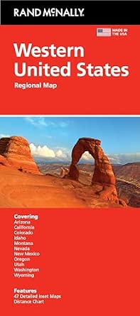 | Best for Western Region Road Trips | Brand: Rand McNally | Product type: Folded map | Coverage: Western United States | VIEW LATEST PRICE | See Our Full Breakdown |
| National Geographic 2027 USA Road Atlas: Adventure Edition |  | Best for Adventure-Minded National Road Trips | Brand: National Geographic | Product type: Road atlas | Coverage: United States | VIEW LATEST PRICE | See Our Full Breakdown |
| Rand McNally Signature Edition U.S. Wall Map, Paper, Rolled |  | Best for a Paper U.S. Wall Display | Brand: Rand McNally | Edition: Signature Edition | Coverage: United States | VIEW LATEST PRICE | See Our Full Breakdown |
| Rand McNally 2027 Easy-to-Read Midsize Road Atlas |  | Best for Readable, Portable Road Reference | Brand: Rand McNally | Year: 2027 | Product type: Midsize road atlas | VIEW LATEST PRICE | See Our Full Breakdown |
| Swiftmaps World Classic Premier Wall Map Poster, Laminated, 24 x 36 Inches |  | Best Laminated World Map | Brand: Swiftmaps | Map type: Political, topographic, world | Dimensions: 24 x 36 inches | VIEW LATEST PRICE | See Our Full Breakdown |
| National Geographic 2027 USA Road Atlas: Midsize Scenic Drives Edition |  | Best for Scenic-Route Planning | Publisher: National Geographic | Edition: Midsize Scenic Drives Edition | Year: 2027 | VIEW LATEST PRICE | See Our Full Breakdown |
| Rand McNally 2027 Large Scale Road Atlas |  | Best for Large-Scale Road Reference | Brand: Rand McNally | Publication year: 2027 | Product type: Road atlas | VIEW LATEST PRICE | See Our Full Breakdown |
| Swiftmaps Contemporary 3D World and USA Wall Map Set, 24 × 36 Inches, Laminated |  | Best World-and-U.S. Wall Map Set | Brand: Swiftmaps | Map type: Topographic | Set size: 2 maps | VIEW LATEST PRICE | See Our Full Breakdown |
| paper map | Brand | ASIN | Coverage | Product type |
|---|---|---|---|---|
| Rand McNally Easy to Read Unit | Rand McNally | 0528027786 | United States | United States map |
| Swiftmaps Classic Elite Lamina | Swiftmaps | — | — | — |
| Rand McNally Classic Edition U | Rand McNally | 0528012789 | United States | — |
| National Geographic Adventure | National Geographic | 1566957125 | — | — |
| Classic Edition World Wall Map | — | — | World | — |
| Rand McNally Folded Map: Easte | Rand McNally | 0528028502 | Eastern United States | Folded map |
| Rand McNally Folded Map: Weste | Rand McNally | 0528028669 | Western United States | Folded map |
| National Geographic 2027 USA R | National Geographic | 0792289897 | United States | Road atlas |
| Rand McNally Signature Edition | Rand McNally | 0528012746 | United States | Wall map |
| Rand McNally 2027 Easy-to-Read | Rand McNally | 0528029517 | — | Midsize road atlas |
| Swiftmaps World Classic Premie | Swiftmaps | — | — | — |
| National Geographic 2027 USA R | — | 1566957060 | United States | Road atlas |
| Rand McNally 2027 Large Scale | Rand McNally | 0528029509 | — | Road atlas |
| Swiftmaps Contemporary 3D Worl | Swiftmaps | — | World and United States | — |
More Details on Our Top Picks
Rand McNally Easy to Read United States Map
The Easy to Read United States Map is the most straightforward choice here for someone who wants a U.S. map without committing to a wall-sized display or a regional adventure map. Its title points to a readability-focused purpose, though the supplied product details do not specify scale, dimensions, finish, or whether it folds or hangs. That lack of format information makes it harder to judge fit than the clearly 48 × 78-inch Swiftmaps wall map, which is built for display and dry-erase marking. Compared with the rolled-paper Rand McNally Classic Edition U.S. Wall Map, this pick may suit buyers prioritizing easy reading over a classic wall-map presentation, but the available data does not confirm its layout or mounting options. I’d choose it for a simple U.S. reference, not for trip planning that needs detailed route coverage.
Pros:- United States coverage serves as a broad geographic reference
- Easy-to-read positioning suits users who prioritize legibility
- A simpler reference-map choice than the Pacific Northwest-focused adventure map
Cons:- Product details do not specify dimensions, scale, or map finish
- Format and mounting options are not provided
- The available information does not establish route-planning detail
Best for: Readers seeking a simple United States map for general reference who do not need confirmed wall-map dimensions or travel-specific detail
Not ideal for: Buyers who need a known size, a laminated write-on surface, or a map explicitly suited to regional trip planning
- Product type:United States map
- Coverage:United States
- Named edition:Easy to Read
- Brand:Rand McNally
- ASIN:0528027786
- Dimensions:Not provided
Our verdict“Choose this for a straightforward U.S. reference when readability matters more than confirmed size, finish, or travel detail.”
Swiftmaps Classic Elite Laminated United States Wall Map, 48 × 78 in
For a shared space where a U.S. map needs to be read from across the room, the 48 × 78-inch format gives this Swiftmaps option a clear advantage over the rolled-paper Rand McNally Classic Edition U.S. Wall Map. Its laminated, dry-erase-compatible surface also lets teachers, planners, or families mark locations and revise them without treating the map as a one-time display. The tradeoff is scale of commitment: this oversized political map needs substantial wall space, and its coated surface may not suit buyers who prefer the traditional paper feel of the Rand McNally wall map. Its listed weight is only 12 ounces, but that does not remove the practical challenge of finding room for a 78-inch-wide map. I’d favor it for group use and frequent annotation, rather than compact storage or travel.
Pros:- Large 48 × 78-inch format is suited to viewing by a group
- Laminated surface supports dry-erase marking and repeated changes
- Political-map format provides a broad U.S. wall reference
- Designed for home, business, and educational settings
Cons:- The 78-inch width requires substantial wall space
- Laminated coating lacks the traditional uncoated-paper feel
- Wall-display format is less practical to store or carry than a folded map
Best for: Teachers, offices, and households with a large clear wall who want to mark and update U.S. locations
Not ideal for: Apartment dwellers, travelers, and buyers who want a portable paper map or have limited wall space
- Brand:Swiftmaps
- Map type:Political
- Dimensions:48 × 78 inches
- Weight:12 ounces
- Finish:Coated
- Surface:Laminated, dry-erase compatible
- Intended settings:Home, business, or educational use
- Color description:48×78 laminated
Our verdict“Pick this oversized laminated map when group visibility and erasable annotations matter more than compactness or a paper finish.”
Rand McNally Classic Edition U.S. Wall Map, Paper, Rolled
This is the clearest fit for buyers who want a traditional paper U.S. wall map rather than a coated teaching surface. Supplied rolled, the Rand McNally Classic Edition arrives in a wall-display format, while the Swiftmaps Classic Elite is much more explicit about size and adds a laminated surface for dry-erase use. That makes the Swiftmaps a stronger choice for frequent annotation, but the paper Rand McNally keeps the appeal simple: a classic map presentation without a stated laminate. The product data does not provide dimensions, scale, or mounting details, so I can’t recommend it for a particular wall size or level of geographic detail. Compared with the Easy to Read United States Map, its wall-map designation makes the intended display use clearer, but it is still not a compact road-trip map.
Pros:- Paper format offers a traditional map surface
- Rolled packaging is suited to wall-map display
- U.S. wall-map designation gives it a clear display purpose
Cons:- Dimensions and scale are not provided
- Paper surface is not specified as dry-erase compatible
- Rolled wall-map format is less convenient for travel than a folded map
Best for: Buyers who want a rolled-paper U.S. wall map for a home, classroom, or office display
Not ideal for: People who need a dry-erase surface, a confirmed map size, or a portable folded map for travel
- Edition:Classic Edition
- Coverage:United States
- Map format:Wall map
- Material:Paper
- Packaging:Rolled
- Brand:Rand McNally
- ASIN:0528012789
Our verdict“Choose this for a classic paper U.S. wall display, but select the Swiftmaps alternative if you need stated dimensions and erasable marking.”
National Geographic Adventure Map: Pacific Northwest, United States (Map 3118)
This pick narrows the map’s job to a specific region: the Pacific Northwest. That focus is its main distinction from the national coverage of the Rand McNally Easy to Read United States Map and the wall-sized Swiftmaps U.S. display. For someone choosing a paper map to explore a defined area, regional coverage can be more useful than a national overview because it keeps attention on the destination rather than the whole country. Still, the supplied details confirm only the map’s name, number, and region; they do not state scale, dimensions, paper finish, or included route and terrain information. I’d treat it as the most geographically focused option in this group, but verify those details before relying on it for a particular journey. It is not the pick for broad U.S. reference or wall display.
Pros:- Pacific Northwest coverage is more focused than a nationwide map
- Adventure-map designation targets regional exploration
- National Geographic branding distinguishes it from the Rand McNally U.S. reference options
Cons:- Dimensions and scale are not included in the supplied details
- Map features and surface or paper finish are unspecified
- Regional coverage cannot replace a map of the full United States
Best for: Travelers and outdoor-oriented readers planning to explore the Pacific Northwest and wanting a region-specific paper map
Not ideal for: Buyers seeking a nationwide overview, a specified wall-map size, or confirmed details about scale and map features
- Brand:National Geographic
- Map type:Adventure Map
- Region:Pacific Northwest, United States
- Map number:3118
- ASIN:1566957125
- Dimensions:Not provided
Our verdict“Pick this for Pacific Northwest-focused exploration, after confirming that its scale and map features suit your planned use.”
Classic Edition World Wall Map, Rolled Paper
The Classic Edition World Wall Map is the only option in this set aimed at a worldwide overview rather than U.S. coverage. That makes it a better match for a classroom, office, or home where the goal is to see countries and continents together; the Rand McNally Classic Edition U.S. Wall Map offers a narrower national focus instead. This map is described as rolled paper, a familiar format for wall display, but the product data does not list dimensions, scale, finish, or any added features. That uncertainty matters more here than with the Swiftmaps U.S. map, whose size and laminated surface are specified. I’d select this for broad world reference and skip it if detailed regional navigation, easy annotation, or a known fit for a particular wall is required.
Pros:- World coverage gives a broader geographic view than the U.S.-only wall maps
- Rolled-paper format suits wall display
- Classic Edition design provides a traditional presentation
Cons:- Dimensions and scale are not provided
- No surface treatment or dry-erase capability is specified
- World coverage may be too broad for detailed regional trip planning
Best for: Teachers, students, and households wanting a rolled-paper world map for broad geographic reference
Not ideal for: Travelers needing regional route detail or buyers who require known dimensions, scale, or a laminated write-on surface
- Edition:Classic Edition
- Coverage:World
- Map format:Wall map
- Material:Paper
- Packaging:Rolled
- Dimensions:Not provided
Our verdict“Choose this for a traditional world-map display, but prefer a region-specific map when practical travel detail matters.”
Rand McNally Folded Map: Eastern United States
This is the regional pick for drivers who want a paper overview of the Eastern United States without carrying a national atlas. Its folded format is more compact than the Rand McNally 2027 Easy-to-Read Midsize Road Atlas, making it a practical backup for a glove compartment or trip folder. The tradeoff is scope: it leaves out the West, and the supplied details don’t specify scale, map dimensions, or whether routes and points of interest are included. I’d choose it for planning or following a trip concentrated in the East, not as a one-map solution for crossing the country. Compared with a full U.S. wall map, it favors portability over a large, at-a-glance display.
Pros:- Regional coverage keeps the map focused on the Eastern United States
- Folded format is easier to store and carry than a wall map
- Offers a paper-based alternative to relying only on digital navigation
Cons:- Does not cover the Western United States
- Product information does not state scale, dimensions, or specific map details
- A single regional sheet may be less useful for broader trip planning than a road atlas
Best for: Drivers planning trips centered on the Eastern United States who want a foldable regional map rather than a full road atlas
Not ideal for: Cross-country travelers who need coverage beyond the East, or readers who need confirmed details about scale, landmarks, or map features before buying
- Brand:Rand McNally
- Product type:Folded map
- Coverage:Eastern United States
- Format:Folded
- Title:Rand McNally Folded Map: Eastern United States
- ASIN:0528028502
Our verdict“Choose this folded map for paper coverage of an Eastern U.S. trip; choose a national atlas if your route extends farther west.”
Rand McNally Folded Map: Western United States
For a trip focused on the West, this folded regional map offers a more portable alternative to carrying the Rand McNally 2027 Large Scale Road Atlas. Its clear distinction from that atlas is scope and format: this is a Western U.S. map, while a national atlas is the better fit for route planning across multiple regions. A folded sheet can suit drivers who want a physical overview without a bound book, though repeated unfolding may be less convenient than flipping atlas pages. The supplied details don’t identify scale, dimensions, or particular road and landmark information, so buyers needing those specifics should verify them before choosing. I’d treat it as a focused regional companion, not a confirmed substitute for detailed navigation.
Pros:- Covers the Western United States as a defined region
- Folded format is easier to carry than a rolled wall map
- Provides a paper overview without requiring an atlas-style book
Cons:- Regional coverage does not include the Eastern United States
- No supplied details confirm scale, dimensions, or road and landmark coverage
- A folded sheet can be less convenient to consult repeatedly than a bound atlas
Best for: Road trippers whose routes stay within the Western United States and who prefer a foldable paper map to a bound atlas
Not ideal for: Travelers crossing the country or buyers who need confirmed scale, dimensions, or named map features
- Brand:Rand McNally
- Product type:Folded map
- Coverage:Western United States
- Format:Folded
- Title:Rand McNally Folded Map: Western United States
- ASIN:0528028669
Our verdict“Pick this for a Western U.S. itinerary when a portable regional sheet suits you better than a national atlas.”
National Geographic 2027 USA Road Atlas: Adventure Edition
The clearest reason to choose this option is its combination of U.S. road-atlas coverage and an Adventure Edition identity. Unlike the regional Rand McNally folded maps, it is positioned for readers planning journeys across the country rather than one side of it. The 2027 edition also gives the title a defined year, but the supplied product data doesn’t describe its page layout, scale, paper, or adventure-specific content. That makes it harder to judge how much detail it offers compared with the Rand McNally 2027 Easy-to-Read Midsize Road Atlas, whose stated emphasis is readability. I’d favor this atlas when nationwide scope and the edition’s adventure framing matter more than confirmed details about legibility or map features.
Pros:- Road atlas format is suited to planning routes across the United States
- 2027 edition year is specified
- Adventure Edition framing differentiates it from standard regional maps
Cons:- No supplied details explain what makes its adventure content distinctive
- Scale, page layout, and physical format are not specified
- The stated information does not establish a readability advantage over Rand McNally’s Easy-to-Read Midsize Road Atlas
Best for: Road-trippers seeking a 2027 U.S.-coverage atlas with an adventure-oriented edition and no need for a region-specific map
Not ideal for: Buyers who require confirmed information about scale, readability, binding, or adventure-related map content before selecting an atlas
- Brand:National Geographic
- Product type:Road atlas
- Coverage:United States
- Edition:Adventure Edition
- Year:2027
- ASIN:0792289897
Our verdict“Choose this if you want a 2027 nationwide road atlas with an adventure-oriented edition, but seek more product detail if map legibility is your priority.”
Rand McNally Signature Edition U.S. Wall Map, Paper, Rolled
This is the lineup’s display-oriented choice: a rolled paper wall map of the United States, rather than a portable road reference. That makes it a better match for a home, classroom, or office where the map can stay visible than either the Rand McNally Folded Map: Eastern United States or a road atlas. Its nationwide coverage gives it broader geographic scope than the folded regional options, while the rolled format avoids creases from folding. The tradeoff is that a wall map needs space and isn’t a convenient item to consult while traveling. Product details don’t specify dimensions, scale, or mounting features, so I wouldn’t assume it fits a particular wall or supports a specific level of detail without checking those points.
Pros:- Shows the United States as a single wall-display map
- Rolled format avoids fold lines
- Paper construction suits buyers seeking a non-digital reference
- Signature Edition distinguishes it from the listed Classic Edition U.S. Wall Map
Cons:- Requires wall or storage space and is not designed as a compact travel map
- Dimensions and scale are not supplied
- No mounting or display hardware details are provided
Best for: Teachers, families, and office users who want a paper map of the United States to keep on display
Not ideal for: Drivers seeking a map to carry in a vehicle, or buyers who need confirmed dimensions and scale before planning a wall installation
- Brand:Rand McNally
- Edition:Signature Edition
- Coverage:United States
- Material:Paper
- Format:Rolled
- Product type:Wall map
- ASIN:0528012746
Our verdict“Choose this for a rolled paper U.S. map that can stay on a wall; choose an atlas or folded regional map for travel use.”
Rand McNally 2027 Easy-to-Read Midsize Road Atlas
The stated advantage here is straightforward: easy-to-read maps in a midsize road atlas. That makes it a strong match for drivers who want a bound paper reference they can consult on a trip, without choosing a single-region folded map. Compared with the National Geographic 2027 USA Road Atlas: Adventure Edition, this listing gives a more specific buying cue—readability—while the National Geographic title emphasizes its Adventure Edition. Midsize also signals a compromise between a larger atlas and a smaller carry option, though exact dimensions and page details aren’t provided. The tradeoff is that the data doesn’t confirm scale, binding, or coverage specifics beyond the road-atlas description. I’d choose it for stated legibility, not for unlisted features.
Pros:- Easy-to-read maps are the stated product emphasis
- Midsize road atlas format is intended as a compromise between portable and larger atlas formats
- 2027 edition year is specified
- Road atlas format offers a book-based alternative to a single folded map
Cons:- Exact dimensions and page count are not provided
- Map scale and specific coverage details are not stated
- The available information does not describe paper, binding, or supplementary features
Best for: Drivers who want a 2027 paper road atlas with an explicit emphasis on readable maps and a midsize format
Not ideal for: Buyers who need exact atlas dimensions, a confirmed scale, or specifically documented regional and landmark coverage
- Brand:Rand McNally
- Year:2027
- Product type:Midsize road atlas
- Map emphasis:Easy-to-read maps
- Format:Atlas
- ASIN:0528029517
Our verdict“Choose this if readable maps in a midsize atlas are your priority; look for more detailed specifications if scale or dimensions drive your decision.”
Swiftmaps World Classic Premier Wall Map Poster, Laminated, 24 x 36 Inches
I’d choose this world wall map for a home, classroom, or office where people need to point out places and add temporary notes. Its political and topographic detail combines country information with shaded land and ocean relief, giving it more visual context than a plain political map. The laminated, UV-coated surface accepts dry-erase marks, so it can support lessons or trip planning without turning into a write-once display. Compared with the Swiftmaps Contemporary 3D World and USA Wall Map Set, this is the simpler choice: one world map rather than two maps, and no U.S. map included. That smaller commitment also means less wall space is needed, though 24 x 36 inches still requires a clear display area. It is a wall reference, not a portable road map, and the supplied details do not specify its scale or geographic labeling density.
Pros:- Combines political information with shaded terrain relief for land and oceans
- Laminated, UV-coated surface supports dry-erase annotations
- Useful as a shared reference in home, work, or school settings
- Single-map format takes less wall space than the two-map Swiftmaps set
Cons:- Requires a clear 24 x 36-inch wall area
- Provides no U.S.-only map for detailed domestic reference
- Listed details do not specify map scale or the density of place labels
Best for: Teachers, families, and office teams who want one reusable world map for pointing, discussion, and dry-erase annotations.
Not ideal for: Travelers seeking a map to carry on a trip, or buyers who need a U.S. map alongside their world map.
- Brand:Swiftmaps
- Map type:Political, topographic, world
- Dimensions:24 x 36 inches
- Paper:24 lb
- Finish:Laminated, UV-coated
- Dry-erase compatible:Yes
- Quantity:1
- Item weight:2.08 ounces
Our verdict“Choose this if you want a reusable, single-sheet world reference; pick the Swiftmaps Contemporary set if you also need a U.S. wall map.”
National Geographic 2027 USA Road Atlas: Midsize Scenic Drives Edition
This atlas earns a distinct place for buyers whose U.S. road trips are about the route as much as the destination. The 2027 edition is identified as a midsize atlas focused on scenic drives, which sets it apart from the Rand McNally 2027 Large Scale Road Atlas: the National Geographic title signals a themed trip-planning angle, while Rand McNally’s listing emphasizes large-scale road mapping. The tradeoff is that the available product details do not describe map scale, included routes, binding, or page count, so I can’t judge how much driving detail or handling convenience it offers. Its U.S. coverage makes it relevant for domestic trips, but the scenic-drive focus may be less useful to someone who mainly needs direct highway routing or a broad, general road reference. Treat it as a specialized paper-atlas choice, not a verified substitute for turn-by-turn directions.
Pros:- Specifically identified as a scenic-drives edition
- Covers the United States for domestic trip planning
- 2027 edition provides a clearly stated publication year
- Midsize designation may suit buyers seeking an atlas format rather than a wall map
Cons:- Available details do not specify scale, page count, or binding
- No listed route examples or explanation of how scenic drives are presented
- The scenic focus may be less useful for routine point-to-point highway planning
Best for: Road trippers choosing destinations and routes around scenic drives across the United States.
Not ideal for: Drivers who want documented large-scale road detail, turn-by-turn directions, or confirmed information about atlas size and construction.
- Publisher:National Geographic
- Edition:Midsize Scenic Drives Edition
- Year:2027
- Coverage:United States
- Product type:Road atlas
- ASIN:1566957060
Our verdict“Pick this National Geographic atlas if scenic routes shape your U.S. road trips, but choose the Rand McNally large-scale atlas when detailed road coverage is the priority.”
Rand McNally 2027 Large Scale Road Atlas
For a buyer who prioritizes road detail over a themed trip-planning angle, this is the most directly targeted option in this group. The title identifies a 2027 road atlas with large-scale maps, a distinction that makes it a clearer fit for close road-reference reading than the National Geographic 2027 USA Road Atlas: Midsize Scenic Drives Edition, which is framed around scenic routes. The available listing is sparse, though: it gives no coverage area, page count, dimensions, binding, or examples of the roads and places shown. That limits how confidently I can recommend it for a particular region or packing setup. Unlike the Swiftmaps wall maps, it is an atlas rather than a fixed display, but the supplied information does not confirm portability or whether it covers beyond the United States. Its appeal is the stated map scale, not a fully documented feature set.
Pros:- Large-scale mapping is expressly identified in the product title
- 2027 publication year is specified
- Road-atlas format differs from fixed wall maps and supports reference away from a display wall
Cons:- Provided information does not state geographic coverage
- No page count, dimensions, or binding details are available
- No listed information describes scenic routes or other specialized content
Best for: Drivers who want a 2027 paper road atlas with large-scale mapping as its defining feature.
Not ideal for: Buyers who need confirmed geographic coverage, atlas dimensions, or scenic-route guidance before choosing.
- Brand:Rand McNally
- Publication year:2027
- Product type:Road atlas
- Map scale description:Large scale
- ASIN:0528029509
- Dimensions:Not specified
Our verdict“Choose this over the scenic-drives atlas if large-scale road mapping is your priority, provided the unspecified coverage and format details meet your needs.”
Swiftmaps Contemporary 3D World and USA Wall Map Set, 24 × 36 Inches, Laminated
This set makes the strongest case for buyers who want world and U.S. coverage together on a wall. Each map measures 24 × 36 inches, and the 3D-style terrain relief gives the display a more dimensional look than the shaded relief on the single-map Swiftmaps World Classic Premier. The glossy laminated finish is dry-erase compatible, so these maps can serve as working references for classes, office discussions, or family trip planning rather than purely decorative posters. Compared with the Classic Premier, the set adds a dedicated U.S. map and specifies heavier 100 lb paper, but the practical cost is wall space: two full-size maps need substantially more room than one. The supplied details also call the map type topographic without listing scale or place-label detail, so I would choose it for broad visual reference rather than fine-grained navigation.
Pros:- Includes both world and United States maps
- Each map has a 3D-style terrain-relief presentation
- Glossy laminated surface supports dry-erase use
- 100 lb paper is specified for both large wall-map sheets
Cons:- Two 24 × 36-inch maps require substantial wall space
- A paired set may be more than needed for buyers seeking only a world map
- Scale and place-label detail are not specified
Best for: Teachers, offices, and households with enough wall space for separate world and U.S. maps that can be marked temporarily.
Not ideal for: Buyers with limited display space, or travelers who need folded maps for use on the road.
- Brand:Swiftmaps
- Map type:Topographic
- Set size:2 maps
- Coverage:World and United States
- Dimensions:24 × 36 inches each
- Paper:100 lb
- Finish:Glossy laminated
- Features:3D visual terrain relief; dry-erase compatible
- Model number:SM WLD USA CONT EL
Our verdict“Choose this set when you need reusable world and U.S. wall references and have room to display both; the Classic Premier is the more space-conscious single-map option.”

How We Picked
I compared these 14 products by the job each one is built to do: driving across the country, planning within a region, or displaying geographic information at home or work. The ranking favors usable map scale, clear reading, practical coverage, and format fit over sheer size or decorative appeal. For road atlases, portability and the ability to consult routes across multiple states mattered; for wall maps, usable dimensions, material, and how well the format suits repeated viewing carried more weight. A regional adventure map was judged on its focused usefulness rather than breadth.
The order reflects how many buyers each option can serve and how well its format matches its likely use. Broadly useful atlases rank ahead of specialized wall or regional choices, while maps with a narrower audience remain valuable when that need is the priority. I also weighed tradeoffs: lamination can help with frequent handling but reduces easy folding, and a large wall map offers more at-a-glance context at the cost of portability. The product lineup includes several similar editions, so distinctions in size, scope, and intended use matter more than small naming differences.
| paper map | Product type | Coverage | Brand |
|---|---|---|---|
| Rand McNally Easy to Read Unit | United States map | United States | Rand McNally |
| Swiftmaps Classic Elite Lamina | — | — | Swiftmaps |
| Rand McNally Classic Edition U | — | United States | Rand McNally |
| National Geographic Adventure | — | — | National Geographic |
| Classic Edition World Wall Map | — | World | — |
| Rand McNally Folded Map: Easte | Folded map | Eastern United States | Rand McNally |
| Rand McNally Folded Map: Weste | Folded map | Western United States | Rand McNally |
| National Geographic 2027 USA R | Road atlas | United States | National Geographic |
| Rand McNally Signature Edition | Wall map | United States | Rand McNally |
| Rand McNally 2027 Easy-to-Read | Midsize road atlas | — | Rand McNally |
| Swiftmaps World Classic Premie | — | — | Swiftmaps |
| National Geographic 2027 USA R | Road atlas | United States | — |
| Rand McNally 2027 Large Scale | Road atlas | — | Rand McNally |
| Swiftmaps Contemporary 3D Worl | — | World and United States | Swiftmaps |
Factors to Consider When Choosing Best Paper Maps
Before choosing a paper map, start with the task it needs to support. A map that works well on a desk may be awkward in a car, and a national atlas may not provide the local detail an outdoor trip calls for. These broader factors can help narrow the format before you compare individual editions.
Match the map’s scale to the decisions you need to make
Scale determines whether you can use a map to see a whole journey at once or inspect a smaller area in greater detail. A national atlas helps with broad route planning, but its pages may not show every local road clearly. A regional map gives more room to focus on a smaller area, which can help when planning stops or exploring a particular region. A common mistake is choosing the broadest coverage available and expecting it to answer detailed local questions. If your trip crosses several states, prioritize continuity and overview; if it stays within one region, prioritize local readability.
Choose a format you will actually consult
Folded maps and atlases serve different habits. A folded map is compact and can be opened to a broad area, but folding it back neatly can take patience and creases may make frequent reference less convenient. An atlas organizes information into pages and is often easier to hold open, though page changes can interrupt route comparisons. Wall maps are useful for shared planning and long-term reference, not for carrying along. Before buying, think about where the map will be read: in a vehicle, at a desk, outdoors, or on a wall.
Treat readability as a practical requirement
Small labels can turn an otherwise detailed map into a frustrating one, especially for readers with limited light or vision. Larger-format maps and easy-to-read editions can reduce squinting, but the larger footprint may be harder to store or use in a confined space. More information is not automatically more useful if the type and symbols become difficult to distinguish. Check whether you need to read route numbers at a glance or mainly want a broad overview. For shared household use, readable labels can matter more than compact storage.
Decide whether durability is worth a less flexible surface
Laminated maps are better suited to repeated handling, marking with compatible tools, or display in places where the surface may need wiping. They are less convenient to fold into a small bag, and a large laminated map can be cumbersome to store without creasing or damage. Paper maps are easier to roll or fold and may suit occasional planning, but they need gentler handling. Avoid paying for a durable finish if the map will stay rolled in a closet. For frequent reference, weigh surface protection against storage and portability.
Separate navigation needs from display and decor
A wall map can be a useful planning aid, but its size and presentation do not make it a substitute for a travel atlas. A world map gives global context, while a U.S. map can show more national detail at the same display scale. Map sets can add visual variety, though they need wall space and may overlap in what they communicate. Ask whether you need a working reference, a teaching aid, or a decorative focal point. Choosing based on that purpose helps avoid buying a striking display that is difficult to use for trip decisions.
Check the coverage and edition before a trip
Map editions can vary in coverage, included routes, and the way information is organized. For a trip, confirm that the map covers every region on your itinerary rather than assuming a national title includes the level of local detail you need. Scenic-drive or adventure-oriented editions may suit exploratory travel better than a general reference, but they may not be the best choice for routine route planning. Paper references can complement digital navigation when service is unreliable, yet they should not be treated as live traffic sources. Match the edition to the places and decisions you expect to face.
Frequently Asked Questions
Should I choose a road atlas or a folded map for a long U.S. road trip?
I’d choose an atlas when the trip crosses several states and you want organized pages for comparing routes and regions. A folded map is more compact and can show a wide area at once, but it may be harder to handle repeatedly or refold during stops. If you expect to make frequent changes or plan from a table, an atlas is usually easier to browse. For a short trip concentrated in one region, a folded regional map can be the simpler companion. Some travelers may prefer carrying both: an atlas for overview and a regional map for focused detail.
Is a laminated wall map a better choice than rolled paper?
It depends on how often the map will be handled and whether it needs to stay on display. Lamination can help protect a map from routine contact and makes the surface more practical for repeated viewing, but a large laminated sheet is less convenient to fold or store. Rolled paper is easier to put away and may suit occasional reference, though it needs careful handling. Also check where the map will hang and how it will be mounted; a large map can require more wall space and support than expected. Choose the finish for its real use, not just because it sounds more durable.
Which type of paper map works best when mobile service is unreliable?
A paper atlas or regional map can provide a dependable reference when a phone cannot load map data, provided you have the right coverage with you. For a multi-state route, a national road atlas offers broad geographic context; for travel centered on one area, a regional map may offer a more useful view. Paper maps do not provide live traffic, automatic rerouting, or current incident information. I’d use one as a backup and planning tool alongside a charged phone or other navigation device. Before leaving, check that the printed map covers your full route and the areas where you may need alternate roads.
How do I choose between a U.S. wall map and a world wall map?
Choose a U.S. map if your main goal is to view domestic states, routes, and geography in a single frame. A world map is better for global context, teaching, or tracking international travel, but it necessarily devotes less space to each country. If you need detailed U.S. trip planning, a wall map may be useful for overview but should be paired with an atlas or regional map. Measure the available wall area before choosing a larger format, and check whether the map will be viewed from across a room. The intended viewing distance can affect how useful small labels feel.
Do I need a specialized scenic-drive or adventure map if I already own a road atlas?
Not always. A general road atlas is the more flexible choice for routine driving and broad route planning, while a specialized edition may offer a better fit for trips built around scenic routes or outdoor exploration. A focused regional map can also make sense when you want to spend time in one area rather than cross the country. The tradeoff is that specialized coverage is less useful beyond its intended route or region. Buy one when its focus changes your planning decisions, not simply to duplicate the overview already in your atlas.
Conclusion
For the broadest driving use, my best overall pick is the Rand McNally 2027 Large Scale Road Atlas; it puts national road reference ahead of easy pocket storage. For best value in everyday usability, the Rand McNally 2027 Easy-to-Read Midsize Road Atlas is a sensible direction for readers who want a more manageable book and clear presentation. The best premium display choice is the Swiftmaps Classic Elite Laminated U.S. Wall Map for buyers who want a large, protected reference on the wall. Beginners may find the Rand McNally Easy to Read United States Map more approachable than a denser atlas, while outdoor-focused buyers should look to the National Geographic Adventure Map: Pacific Northwest. For global display, choose a Swiftmaps world map; for portable regional coverage, compare the Eastern and Western folded maps against your route. Pick the format that matches where and how you will read it, and the right map becomes much easier to identify.
Halloween Picks
halloween
As an affiliate, we earn on qualifying purchases.